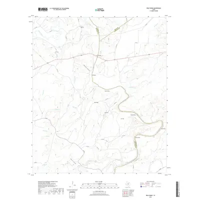
2019 Map of Wolf Ridge
USGS Topo · Published 2019About this map
The San Saba River and Colorado River define the boundary lines of Mills, San Saba, and Lampasas Counties in this Central Texas landscape. The terrain is deeply carved by drainage systems like Molasses Hollow and Rabbit Hollow, which lead toward significant vertical landmarks such as Red Bluff and Raven Cliff. This rural area is anchored by the Wolf Ridge settlement and smaller locales like Sand Rock. Genealogists and local historians will find value in the documentation of the Harmony Ridge Cem and Harris Cem, along with several water sources including Pecan Pool Spring and Blue Pool Spring. The network of county roads and Us 190 connects these disparate points, crossing the river at the US 190 Bridge.
Find a feature on this map
59 named features on this map. Tap any name to fly to it.
Don’t see what you’re looking for? This feature index may not catch every label — zoom into the map to look around manually.
Map Details
Editions of this 2019 Wolf Ridge Map
This is the sole edition of this map. No revisions or reprints were ever made.
Other maps of this area

1885 · San Saba
USGS Topo · 1:125,000

1887 · Lampasas
USGS Topo · 1:125,000

1894 · Lampasas
USGS Topo · 1:125,000

1894 · San Saba
USGS Topo · 1:125,000

1925 · San Saba 4-a
USGS Topo · 1:48,000

1925 · San Saba 1-c
USGS Topo · 1:48,000

1925 · San Saba 1-d
USGS Topo · 1:48,000

1928 · Goldthwaite
USGS Topo · 1:62,500

1931 · Bend
USGS Topo · 1:62,500

1948 · Goldthwaite
USGS Topo · 1:62,500