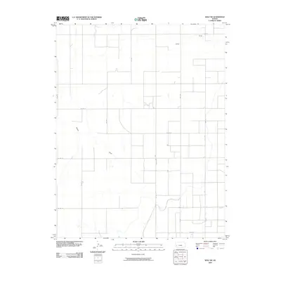
2009 Map of Wolf SW
USGS Topo · Published 2009About this map
James Draw and Mattox Draw define the seasonal drainage patterns across this section of the High Plains in western Kansas. The landscape is organized by a rigorous section-line road grid typical of the region's agricultural development, with routes such as Co Rd 14, Co Rd 16, and Co Rd 18 facilitating travel between remote farmsteads. The presence of West St and the designated Fas 1523 arterial suggests a transition toward more established local infrastructure. This 2009 survey by the U.S. Geological Survey utilizes data from the National Hydrography Dataset and the National Transportation Dataset to record the essential water and transport networks that sustain the rural economy in this part of Kearny County.
Find a feature on this map
16 named features on this map. Tap any name to fly to it.
Don’t see what you’re looking for? This feature index may not catch every label — zoom into the map to look around manually.
Map Details
Editions of this 2009 Wolf SW Map
This is the sole edition of this map. No revisions or reprints were ever made.
Other maps of this area

1891 · Larned
USGS Topo · 1:125,000

1900 · Lakin
USGS Topo · 1:125,000

1955 · Dodge City
USGS Topo · 1:250,000

1955 · Scott City
USGS Topo · 1:250,000

1958 · Dodge City
USGS Topo · 1:250,000

1958 · Scott City
USGS Topo · 1:250,000

1959 · Dodge City
USGS Topo · 1:250,000

1960 · Deerfield
USGS Topo · 1:24,000
1960 · Deerfield NE
USGS Topo · 1:24,000
1965 · Wolf
USGS Topo · 1:24,000