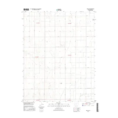
2015 Map of Wolf SW
USGS Topo · Published 2015About this map
Lake McKinney anchors the southern boundary of this high plains landscape in Kearny County, where ephemeral watercourses define the drainage patterns of the region. The map captures the subtle topography of the Great Plains, featuring the winding paths of James Draw and Mattox Draw. These seasonal stream beds are surrounded by a systematic grid of section lines and county roads, such as Co Rd 11 and Co Rd 190, reflecting the enduring structure of the Public Land Survey System across Township 22 South to Township 24 South. This 2015 survey illustrates how modern infrastructure, including the curiously named Rd 200County Road 200, overlays a traditional agricultural landscape where water management remains the primary geographical influence.
Find a feature on this map
31 named features on this map. Tap any name to fly to it.
Don’t see what you’re looking for? This feature index may not catch every label — zoom into the map to look around manually.
Map Details
Editions of this 2015 Wolf SW Map
This is the sole edition of this map. No revisions or reprints were ever made.
Other maps of this area

1891 · Larned
USGS Topo · 1:125,000

1900 · Lakin
USGS Topo · 1:125,000

1955 · Dodge City
USGS Topo · 1:250,000

1955 · Scott City
USGS Topo · 1:250,000

1958 · Dodge City
USGS Topo · 1:250,000

1958 · Scott City
USGS Topo · 1:250,000

1959 · Dodge City
USGS Topo · 1:250,000

1960 · Deerfield
USGS Topo · 1:24,000
1960 · Deerfield NE
USGS Topo · 1:24,000
1965 · Wolf
USGS Topo · 1:24,000