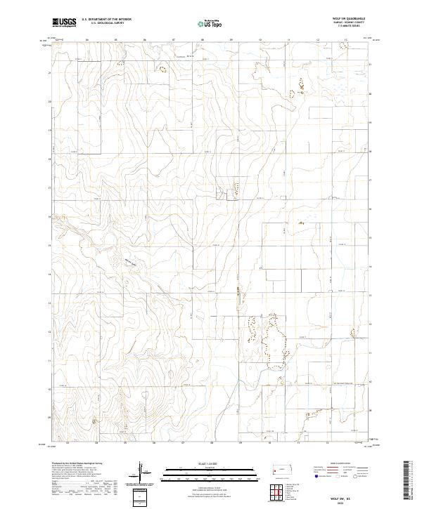
2022 Map of Wolf SW
USGS Topo · Published 2022About this map
James Draw and Mattox Draw define the intermittent drainage patterns across this stretch of the High Plains in western Kansas. The landscape is characterized by a precise, sprawling grid of section lines and county roads, reflecting the enduring legacy of the Public Land Survey System. Prominent thoroughfares such as Co Rd 11 and Co Rd 13 provide access across the townships, while north-south routes like Co Rd R and West St connect the isolated ranching and agricultural tracts.
Find a feature on this map
28 named features on this map. Tap any name to fly to it.
Don’t see what you’re looking for? This feature index may not catch every label — zoom into the map to look around manually.
Map Details
Editions of this 2022 Wolf SW Map
This is the sole edition of this map. No revisions or reprints were ever made.
Other maps of this area

1891 · Larned
USGS Topo · 1:125,000

1900 · Lakin
USGS Topo · 1:125,000

1955 · Dodge City
USGS Topo · 1:250,000

1955 · Scott City
USGS Topo · 1:250,000

1958 · Dodge City
USGS Topo · 1:250,000

1958 · Scott City
USGS Topo · 1:250,000

1959 · Dodge City
USGS Topo · 1:250,000

1960 · Deerfield
USGS Topo · 1:24,000
1960 · Deerfield NE
USGS Topo · 1:24,000
1965 · Wolf
USGS Topo · 1:24,000