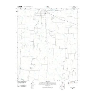
2010 Map of Wolfe City
USGS Topo · Published 2010About this map
Wolfe City serves as the primary hub of this North Texas landscape, where a grid of rural roads connects scattered agricultural communities and local landmarks. The area is defined by the drainage of the South Sulphur River and its numerous tributaries, including Honey Creek and Turkey Creek. Small settlements like Aberfoyle, White Rock, and South Sulphur are anchored by family-named sites and rural institutions, such as the Wesley Church and its accompanying Wesley Church Cemetery. For genealogists, the map is particularly rich in burial sites, documenting Mount Carmel Cemetery, Onstot Cemetery, and Henington Cemetery. Two aviation sites, Henington Airport and Magee Airport, along with the Wolfe City Reservoirs, reflect the modern infrastructure supporting this rural corner of Hunt County at the time of the 2008 imagery.
Find a feature on this map
77 named features on this map. Tap any name to fly to it.
Don’t see what you’re looking for? This feature index may not catch every label — zoom into the map to look around manually.
Map Details
Editions of this 2010 Wolfe City Map
This is the sole edition of this map. No revisions or reprints were ever made.
Other maps of this area

1953 · Texarkana
USGS Topo · 1:250,000

1954 · Sherman
USGS Topo · 1:250,000

1956 · Texarkana
USGS Topo · 1:250,000

1958 · Sherman
USGS Topo · 1:250,000

1962 · Greenville NW
USGS Topo · 1:24,000

1963 · Greenville NE
USGS Topo · 1:24,000

1964 · Commerce South
USGS Topo · 1:24,000

1964 · Commerce North
USGS Topo · 1:24,000

1964 · Celeste
USGS Topo · 1:24,000

1964 · Ladonia
USGS Topo · 1:24,000