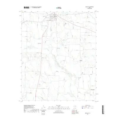
2019 Map of Wolfe City
USGS Topo · Published 2019About this map
Wolfe City serves as the focal point of this Hunt County survey, where a grid of streets including W Witt St, S Austin St, and Santa Fe St defines the urban center. The surrounding landscape is carved by an extensive network of waterways, most notably the S Sulphur River and its tributaries such as Turkey Cr, Oyster Cr, and Honey Cr. Small-scale aviation landmarks like Magee Airport and Card Aerodrome are scattered across the rural periphery, alongside quiet settlements like Aberfoyle and South Sulphur.
Find a feature on this map
102 named features on this map. Tap any name to fly to it.
Don’t see what you’re looking for? This feature index may not catch every label — zoom into the map to look around manually.
Map Details
Editions of this 2019 Wolfe City Map
This is the sole edition of this map. No revisions or reprints were ever made.
Other maps of this area

1953 · Texarkana
USGS Topo · 1:250,000

1954 · Sherman
USGS Topo · 1:250,000

1956 · Texarkana
USGS Topo · 1:250,000

1958 · Sherman
USGS Topo · 1:250,000

1962 · Greenville NW
USGS Topo · 1:24,000

1963 · Greenville NE
USGS Topo · 1:24,000

1964 · Commerce South
USGS Topo · 1:24,000

1964 · Commerce North
USGS Topo · 1:24,000

1964 · Celeste
USGS Topo · 1:24,000

1964 · Ladonia
USGS Topo · 1:24,000