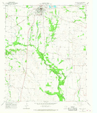
1965 Map of Wolfe City
USGS Topo · Published 1968About this map
Wolfe City sits at the heart of this North Texas landscape, where the Sante Fe and Atchison Topeka railroad corridor converges with a network of rural roads and water bodies. The geography is defined by the winding paths of the Middle Sulphur River and South Sulphur River, which drain the surrounding agricultural lands. Notable for its many family and community landmarks, the area includes several rural burial grounds such as Westbrook Cem, Onstot Cem, and Kelley Cem. Outside the main town, the small settlement of Aberfoyle serves as a local waypoint, while the Wolfe City Reservoirs and Henington Landing Area provide critical water management. The presence of numerous small churches, including Honey Creek Ch and Wesley Ch, suggests a well-established social fabric in the mid-1960s, deeply rooted in the soil of Hunt Co and Fannin Co.
Find a feature on this map
31 named features on this map. Tap any name to fly to it.
Don’t see what you’re looking for? This feature index may not catch every label — zoom into the map to look around manually.
Map Details
Editions of this 1965 Wolfe City Map
This is the sole edition of this map. No revisions or reprints were ever made.
Other maps of this area

1953 · Texarkana
USGS Topo · 1:250,000

1954 · Sherman
USGS Topo · 1:250,000

1956 · Texarkana
USGS Topo · 1:250,000

1958 · Sherman
USGS Topo · 1:250,000

1962 · Greenville NW
USGS Topo · 1:24,000

1963 · Greenville NE
USGS Topo · 1:24,000

1964 · Commerce South
USGS Topo · 1:24,000

1964 · Commerce North
USGS Topo · 1:24,000

1964 · Celeste
USGS Topo · 1:24,000

1964 · Ladonia
USGS Topo · 1:24,000