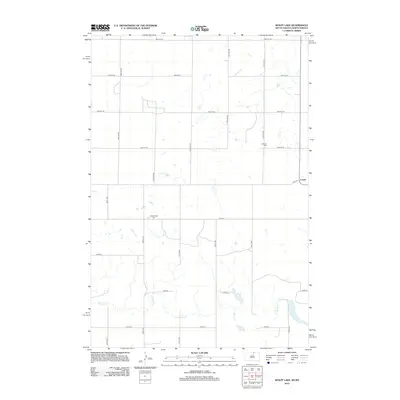
2012 Map of Wolff Lake
USGS Topo · Published 2012About this map
Lowell stands as a primary point of reference in this borderland region between North and South Dakota. The landscape is defined by the hydrologic network of Spring Cr, which flows toward the namesake Wolff Lake. These water features dictated the layout of the rural road grid, where long stretches of 101st St SE and 104th St intersect the north-south section lines. For genealogists and local historians, the map preserves the locations of the Johannestal Cem and the Lutheran Cem, marking the early settlement nodes of the agrarian community. The terrain is characterized by numerous small prairie potholes and depressions scattered across the McIntosh County countryside, typical of the glaciated plains of the northern prairies.
Find a feature on this map
26 named features on this map. Tap any name to fly to it.
Don’t see what you’re looking for? This feature index may not catch every label — zoom into the map to look around manually.
Map Details
Editions of this 2012 Wolff Lake Map
This is the sole edition of this map. No revisions or reprints were ever made.
Other maps of this area

1953 · Jamestown
USGS Topo · 1:250,000

1954 · Aberdeen
USGS Topo · 1:250,000

1956 · Aberdeen
USGS Topo · 1:250,000

1956 · Jamestown
USGS Topo · 1:250,000

1978 · Wolff Lake
USGS Topo · 1:24,000

1978 · Venturia
USGS Topo · 1:24,000

1978 · Eureka East
USGS Topo · 1:24,000

1978 · Schumacher Lake
USGS Topo · 1:24,000

1978 · Schumacher Lake SW
USGS Topo · 1:24,000

1978 · Schumacher Lake NE
USGS Topo · 1:24,000