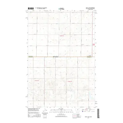
2015 Map of Wolff Lake
USGS Topo · Published 2015About this map
The settlement of Lowell sits near the divide between North Dakota and South Dakota, marking a landscape defined by the drainage of Spring Creek. This 2015 survey illustrates a rural borderland where the township lines of McIntosh County, North Dakota, meet McPherson County, South Dakota. Family history is anchored by the presence of Johannestal Cem and Lutheran Cem, providing vital reference points for genealogical research in this sparsely populated prairie region. The terrain is characterized by numerous depressions and wetlands typical of the Missouri Coteau, including the namesake Wolf Lake. A grid of section-line roads, such as 100th St and 337th Ave, provides access to the agricultural tracts that dominate the area, while the meandering path of Spring Cr cuts through the southern reaches, highlighting the natural water system before it crosses state lines.
Find a feature on this map
31 named features on this map. Tap any name to fly to it.
Don’t see what you’re looking for? This feature index may not catch every label — zoom into the map to look around manually.
Map Details
Editions of this 2015 Wolff Lake Map
This is the sole edition of this map. No revisions or reprints were ever made.
Other maps of this area

1953 · Jamestown
USGS Topo · 1:250,000

1954 · Aberdeen
USGS Topo · 1:250,000

1956 · Aberdeen
USGS Topo · 1:250,000

1956 · Jamestown
USGS Topo · 1:250,000

1978 · Wolff Lake
USGS Topo · 1:24,000

1978 · Venturia
USGS Topo · 1:24,000

1978 · Eureka East
USGS Topo · 1:24,000

1978 · Schumacher Lake
USGS Topo · 1:24,000

1978 · Schumacher Lake SW
USGS Topo · 1:24,000

1978 · Schumacher Lake NE
USGS Topo · 1:24,000