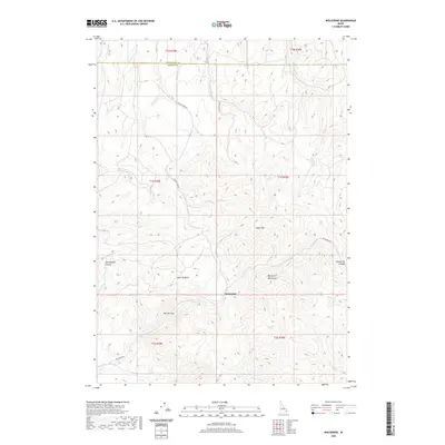
2020 Map of Wolverine
USGS Topo · Published 2020About this map
Taylor Mtn and the Blackfoot Mountains dominate this high-desert landscape in southeast Idaho, where the Bonneville Co and Bingham Co line cuts through the northern sections. The settlement of Wolverine serves as a central point in a topography defined by significant drainages and seasonal watercourses. Natural corridors like Wolverine Canyon and Rattlesnake Canyon carve through the terrain, while The Narrows provides a distinctive passage along Wolverine Cr. This modern survey illustrates how long-established routes like Wolverine Rd and Taylor Creek Rd continue to navigate the complex system of basins and ridges, including Saw Log Basin. Local hydrology is mapped in detail, showing the paths of Dry Fork, Henry Cr, and Sellars Cr as they move through the high country.
Find a feature on this map
27 named features on this map. Tap any name to fly to it.
Don’t see what you’re looking for? This feature index may not catch every label — zoom into the map to look around manually.
Map Details
Editions of this 2020 Wolverine Map
This is the sole edition of this map. No revisions or reprints were ever made.
Other maps of this area

1918 · Paradise Valley
USGS Topo · 1:62,500

1924 · Ammon
USGS Topo · 1:62,500

1948 · Idaho Falls South
USGS Topo · 1:24,000

1950 · Idaho Falls South
USGS Topo · 1:24,000

1950 · Goshen
USGS Topo · 1:24,000

1951 · Higham Peak
USGS Topo · 1:24,000

1952 · Goshen
USGS Topo · 1:24,000

1955 · Yandell Springs
USGS Topo · 1:62,500

1955 · Idaho Falls
USGS Topo · 1:250,000

1955 · Driggs
USGS Topo · 1:250,000