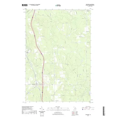
2019 Map of Wolverine
USGS Topo · Published 2019About this map
The Sturgeon River and its various branches dominate the landscape of southern Cheboygan County, providing a central corridor for both natural drainage and human transport. The village of Wolverine sits at a significant fork where the W Br Sturgeon River joins the main stem, while the smaller settlement of Rondo lies just to the north. This area reflects a modern transition from industrial rail use to recreation, as the N Central State Trail now follows the path through the river valley once occupied by the railroad, connecting these communities via a historical transportation artery.
Find a feature on this map
87 named features on this map. Tap any name to fly to it.
Don’t see what you’re looking for? This feature index may not catch every label — zoom into the map to look around manually.
Map Details
Editions of this 2019 Wolverine Map
This is the sole edition of this map. No revisions or reprints were ever made.
Other maps of this area

1954 · Gaylord
USGS Topo · 1:62,500

1954 · Hetherton
USGS Topo · 1:62,500

1955 · Cheboygan
USGS Topo · 1:250,000

1957 · Tower
USGS Topo · 1:62,500

1957 · Wolverine
USGS Topo · 1:62,500

1958 · Cheboygan
USGS Topo · 1:250,000

1982 · Petoskey
USGS Topo · 1:100,000
1986 · Legrand
USGS Topo · 1:24,000
1986 · Green Timbers
USGS Topo · 1:24,000
1986 · Wildwood
USGS Topo · 1:24,000