2023 Map of Wolverine
USGS Topo · Published 2023About this map
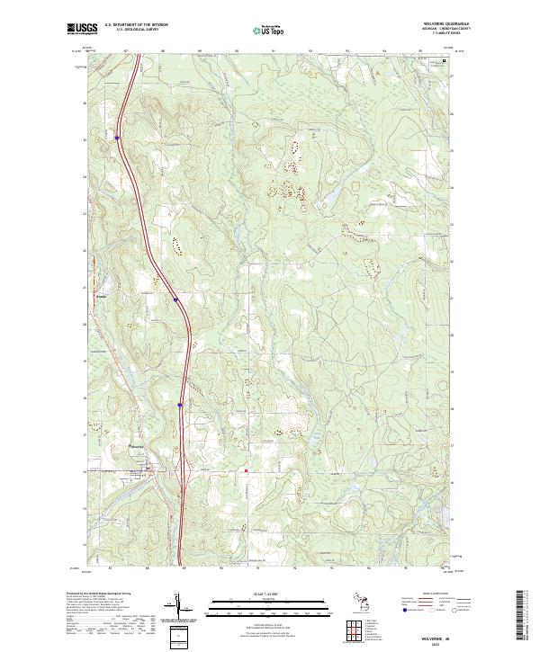
The Sturgeon River and its numerous tributaries, including the West Branch Sturgeon River and Little Sturgeon River, define the landscape around the village of Wolverine. This northern Michigan corridor shows a distinct pattern of settlement and transit, where the village and the nearby community of Rondo are oriented along the primary north-south river valley. To the east, the terrain becomes more varied with numerous isolated water bodies such as Corey Lake, Goose Pond, and the evocatively named Holy Smoke Lake. The map reveals a network of rural routes and trails, like Beebe School Rd and Afton Rd, which provide access to these remote wetlands and forested areas. In the northeastern corner, Saint Monica's Catholic Cem serves as a lone landmark for local family historians tracing heritage in this part of Cheboygan County.
Find a feature on this map
90 named features on this map. Tap any name to fly to it.
Don’t see what you’re looking for? This feature index may not catch every label — zoom into the map to look around manually.
Map Details
Editions of this 2023 Wolverine Map
This is the sole edition of this map. No revisions or reprints were ever made.
Historical Maps of Rondo Through Time
3 maps found