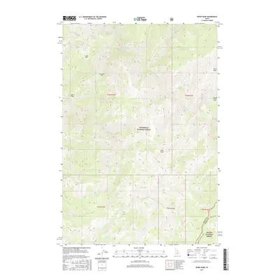
2017 Map of Wood Hump
USGS Topo · Published 2017About this map
The Selway River carves a deep path through this portion of the northern Rockies, dividing a landscape dominated by high ridges and localized mountain flats. This 2017 survey documents the intersection of the Bitterroot National Forest and the Salmon National Forest, showing a wilderness character defined by steep elevation changes. Notable clearings and relatively level ground are found at Thompson Flat and Storm Creek Flat, which provide rare points of lower-relief terrain amidst the surrounding crests of Goat Ridge and Storm Ridge.
Find a feature on this map
30 named features on this map. Tap any name to fly to it.
Don’t see what you’re looking for? This feature index may not catch every label — zoom into the map to look around manually.
Map Details
Editions of this 2017 Wood Hump Map
This is the sole edition of this map. No revisions or reprints were ever made.
Other maps of this area

1956 · Elk City
USGS Topo · 1:250,000

1960 · Elk City
USGS Topo · 1:250,000

1962 · Wood Hump
USGS Topo · 1:24,000

1962 · Beaver Jack Mtn
USGS Topo · 1:24,000

1962 · Blue Joint
USGS Topo · 1:24,000

1962 · Square Top
USGS Topo · 1:24,000

1962 · Horse Creek Butte
USGS Topo · 1:24,000

1962 · Nez Perce Peak
USGS Topo · 1:24,000

1978 · Waugh Mountain
USGS Topo · 1:24,000

1978 · Magruder Mtn
USGS Topo · 1:24,000