1985 Map of Wood Lake NE
USGS Topo · Published 1986About this map
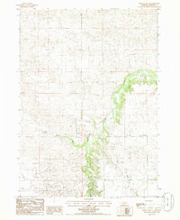
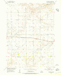
Plum Creek meanders through the central Nebraska Sandhills in this mid-1980s topographical study of Brown County. The landscape is defined by the intricate drainage patterns of the Little Minnie Creek and the Sand Draw, showing the subtle but critical elevation changes that dictate water movement in this prairie environment. This provisional survey captures the region's rural character and hydrologic network just as modern satellite imaging was beginning to supplement traditional field checking. The lack of named settlements or heavy infrastructure highlights the expansive, undeveloped nature of these ranchlands, where natural watercourses like Plum Creek serve as the primary landmarks for navigating the undulating terrain.
Find a feature on this map
3 named features on this map. Tap any name to fly to it.
Don’t see what you’re looking for? This feature index may not catch every label — zoom into the map to look around manually.
Map Details
Editions of this 1985 Wood Lake NE Map
This is the sole edition of this map. No revisions or reprints were ever made.
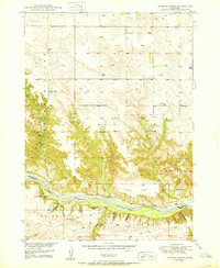
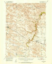
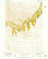
Other maps of this area

1950 · Norden
USGS Topo · 1:62,500
1950 · Huddle Table
USGS Topo · 1:24,000
1950 · Wood Lake
USGS Topo · 1:62,500

1952 · Norden
USGS Topo · 1:62,500
1954 · Ainsworth NW
USGS Topo · 1:24,000
1954 · Ainsworth SW
USGS Topo · 1:24,000

1955 · O'Neill
USGS Topo · 1:250,000

1957 · Valentine
USGS Topo · 1:250,000

1959 · Valentine
USGS Topo · 1:250,000

1959 · O'Neill
USGS Topo · 1:250,000