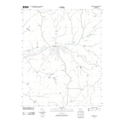
2010 Map of Woodbury
USGS Topo · Published 2010About this map
Woodbury sits at the heart of this landscape where the East Fork Stones River carves a path through numerous ridges and hollows. This 2010 survey reveals a community deeply connected to its rural ancestry, evidenced by the density of family burial grounds scattered throughout the surrounding hills. Genealogists can trace lineage at sites like Riverside Cemetery, Gaither Cemetery, and Smithson Cemetery. The terrain is defined by its many named valleys, including Bernal Hollow, Woods Hollow, and Preston Hollow, which follow the winding courses of local waterways like Hollis Creek and Hill Creek. Rising above the valley floor, landmarks such as Manchester Hill and Sugartree Knob illustrate the topographic complexity of Cannon County, while a network of rural roads like Jimtown Rd and Basham Ridge Rd connects the outlying settlements and farms to the town center.
Find a feature on this map
93 named features on this map. Tap any name to fly to it.
Don’t see what you’re looking for? This feature index may not catch every label — zoom into the map to look around manually.
Map Details
Editions of this 2010 Woodbury Map
This is the sole edition of this map. No revisions or reprints were ever made.
Other maps of this area

1893 · Mc Minnville
USGS Topo · 1:125,000

1895 · Mc Minnville
USGS Topo · 1:125,000

1908 · Woodbury
USGS Topo · 1:62,500

1913 · Hollow Springs
USGS Topo · 1:62,500

1936 · Beech Grove
USGS Topo · 1:24,000

1936 · Petty Gap
USGS Topo · 1:24,000

1942 · Statesville
USGS Topo · 1:100,000

1943 · Mc Minnville
USGS Topo · 1:100,000

1952 · Centertown
USGS Topo · 1:24,000

1953 · Chattanooga
USGS Topo · 1:250,000