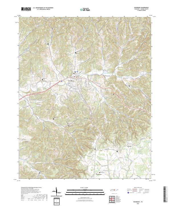
2022 Map of Woodbury
USGS Topo · Published 2022About this map
The Cannon County Courthouse serves as the focal point of Woodbury, where the E Fork Stones River meanders through a landscape defined by deep hollows and prominent ridges. This 2022 survey captures a community deeply rooted in its local geography, with numerous family-named landmarks such as Manchester Hill and Prospect Hill providing a sense of historical continuity. The layout of the town follows the natural curves of the terrain, with residential streets giving way to rural roads that lead into the surrounding hills.
Find a feature on this map
186 named features on this map. Tap any name to fly to it.
Don’t see what you’re looking for? This feature index may not catch every label — zoom into the map to look around manually.
Map Details
Editions of this 2022 Woodbury Map
This is the sole edition of this map. No revisions or reprints were ever made.
Other maps of this area

1893 · Mc Minnville
USGS Topo · 1:125,000

1895 · Mc Minnville
USGS Topo · 1:125,000
1908 · Woodbury
USGS Topo · 1:62,500
1913 · Hollow Springs
USGS Topo · 1:62,500
1936 · Beech Grove
USGS Topo · 1:24,000
1936 · Petty Gap
USGS Topo · 1:24,000

1942 · Statesville
USGS Topo · 1:100,000
1943 · Mc Minnville
USGS Topo · 1:100,000
1952 · Centertown
USGS Topo · 1:24,000
1953 · Chattanooga
USGS Topo · 1:250,000