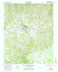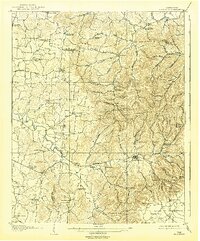
1908 Map of Woodbury
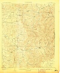
USGS Topo · Published 1939About this map
Woodbury serves as the central hub of this early 20th-century landscape where Cannon, Rutherford, and Wilson counties converge. The terrain is defined by the winding waters of the East Fork Stone River and Smith Fork, which supported early rural industries like McPeaks Mill and Hoovers Mill. Settlement patterns follow the river valleys and the historic Murfreesboro Turnpike, with a high density of community institutions including the Willow Swamp School, Knight School, and Oregon Church. The map details a transition from the lower river bottoms to the elevated Plateau of the Barrens in the southeast. For genealogists, the numerous family-named landmarks such as Bogies Store and the County Farm provide evidence of rural life and social structure in Middle Tennessee before modern highway development reshaped these communities.
Find a feature on this map
85 named features on this map. Tap any name to fly to it.
Don’t see what you’re looking for? This feature index may not catch every label — zoom into the map to look around manually.
Map Details
Editions of this 1908 Woodbury Map
2 editions found
Historical Maps of Woodbury Through Time
7 maps found