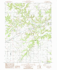
1985 Map of Woodbury
USGS Topo · Published 1985About this map
Illinois Central Gulf rail lines cut through the center of this Central Illinois landscape, connecting the small settlements of Woodbury, Jewett, and Montrose during the mid-1980s. The terrain is defined by a dense network of drainage, including the winding paths of Muddy Creek, Cottonwood Creek, and Island Creek, which carve through the townships of Sumpter, Spring Point, and St Francis.
Find a feature on this map
23 named features on this map. Tap any name to fly to it.
Don’t see what you’re looking for? This feature index may not catch every label — zoom into the map to look around manually.
Map Details
Editions of this 1985 Woodbury Map
This is the sole edition of this map. No revisions or reprints were ever made.
Other maps of this area

1933 · Toledo
USGS Topo · 1:62,500

1934 · Mattoon
USGS Topo · 1:62,500

1937 · Mattoon
USGS Topo · 1:62,500

1938 · Toledo
USGS Topo · 1:62,500

1940 · Greenup
USGS Topo · 1:62,500

1943 · Greenup
USGS Topo · 1:62,500

1953 · Teutopolis
USGS Topo · 1:62,500

1958 · Decatur
USGS Topo · 1:250,000

1961 · Decatur
USGS Topo · 1:250,000
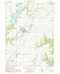
1984 · Neoga
USGS Topo · 1:24,000