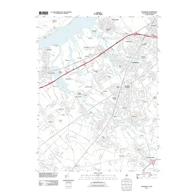
2011 Map of Woodbury
USGS Topo · Published 2011About this map
Woodbury and its surrounding residential boroughs define this suburban landscape in Gloucester County, where the dense grid of neighborhoods like Colonial Manor and Woodbury Gardens meets the tidal waterways of the Delaware River basin. The area is heavily intersected by the New Jersey Tpke S, yet it maintains distinct community boundaries through a network of creeks, including Mantua Creek and Woodbury Creek. Local history is anchored by numerous cemeteries such as Green Cemetery and Wenonah Cemetery, as well as industrial and transport markers like the Shell-Woodbury Number One and Peaslees Airstrip. To the west, the riverfront is characterized by Washington Point Neck and Hog Island, while smaller settlements like Thorofare and Billingsport reflect the region's long-standing connection to the waterfront and regional commerce.
Find a feature on this map
76 named features on this map. Tap any name to fly to it.
Don’t see what you’re looking for? This feature index may not catch every label — zoom into the map to look around manually.
Map Details
Editions of this 2011 Woodbury Map
This is the sole edition of this map. No revisions or reprints were ever made.
Other maps of this area

1890 · Salem
USGS Topo · 1:62,500

1890 · Glassboro
USGS Topo · 1:62,500

1891 · Philadelphia
USGS Topo · 1:62,500

1894 · Chester
USGS Topo · 1:62,500

1894 · Philadelphia
USGS Topo · 1:62,500

1896 · Philadelphia
USGS Topo · 1:62,500

1896 · Chester
USGS Topo · 1:62,500

1898 · Salem
USGS Topo · 1:62,500

1898 · Glassboro
USGS Topo · 1:62,500

1898 · Chester
USGS Topo · 1:62,500
Featured Places
- Philadelphia, PA
- Washington Township, NJ
- Deptford Township, NJ
- West Deptford Township, NJ
- Mantua Township, NJ