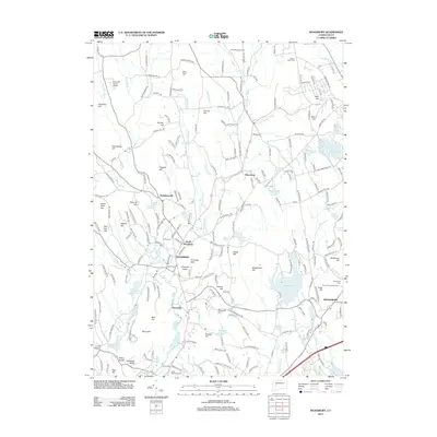
2012 Map of Woodbury
USGS Topo · Published 2012About this map
Woodbury and its surrounding hillsides are defined by the convergence of the Nonnewaug River and Weekeepeemee River as they form the Pomperaug River system. The landscape transition from the village center through Hotchkissville to the higher elevations of Orenaug Hills and Joshua Hill reflects a classic New England pattern of valley-floor settlement flanked by steep, rocky terrain. To the north, Flanders Wildlife Pond and the extensive grounds of Paradise Valley Farm highlight the area's preserved open spaces and agricultural heritage.
Find a feature on this map
229 named features on this map. Tap any name to fly to it.
Don’t see what you’re looking for? This feature index may not catch every label — zoom into the map to look around manually.
Map Details
Editions of this 2012 Woodbury Map
This is the sole edition of this map. No revisions or reprints were ever made.
Other maps of this area

1889 · Derby
USGS Topo · 1:62,500

1891 · Derby
USGS Topo · 1:62,500

1892 · Danbury
USGS Topo · 1:62,500

1892 · New Milford
USGS Topo · 1:62,500

1893 · Waterbury
USGS Topo · 1:62,500

1893 · New Milford
USGS Topo · 1:62,500

1893 · Derby
USGS Topo · 1:62,500

1904 · New Milford
USGS Topo · 1:62,500

1904 · Waterbury
USGS Topo · 1:62,500

1904 · Litchfield
USGS Topo · 1:125,000