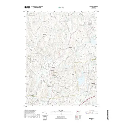
2018 Map of Woodbury
USGS Topo · Published 2018About this map
Woodbury Center and the surrounding Litchfield County hills are mapped here in the late 2010s, showing a landscape defined by its glacial heritage and colonial-era settlement patterns. The Pomperaug River and Nonnewaug River valleys provide the level ground for clusters like North Woodbury and Hotchkissville, while the upland terrain is marked by numerous named peaks including Orenaug Hills and Caleb Hill. Genealogists will find several important burial grounds preserved, from the North Cem and South Cem to the Mount Olive Cem near the northern boundary. The eastern edge transition into the New Haven County town of Middlebury, dominated by Lake Quassapaug. This map captures the modern balance of suburban development alongside protected spaces like the Flanders Wildlife Pond, reflecting the region's long-standing emphasis on land conservation.
Find a feature on this map
239 named features on this map. Tap any name to fly to it.
Don’t see what you’re looking for? This feature index may not catch every label — zoom into the map to look around manually.
Map Details
Editions of this 2018 Woodbury Map
This is the sole edition of this map. No revisions or reprints were ever made.
Other maps of this area

1889 · Derby
USGS Topo · 1:62,500

1891 · Derby
USGS Topo · 1:62,500

1892 · Danbury
USGS Topo · 1:62,500

1892 · New Milford
USGS Topo · 1:62,500

1893 · Waterbury
USGS Topo · 1:62,500

1893 · New Milford
USGS Topo · 1:62,500

1893 · Derby
USGS Topo · 1:62,500

1904 · New Milford
USGS Topo · 1:62,500

1904 · Waterbury
USGS Topo · 1:62,500

1904 · Litchfield
USGS Topo · 1:125,000