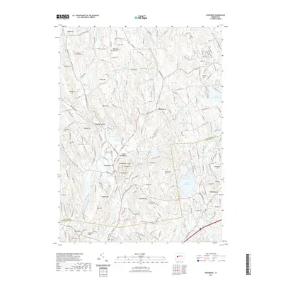
2021 Map of Woodbury
USGS Topo · Published 2021About this map
The Weekeepeemee River and Nonnewaug River converge near Woodbury, shaping a valley floor that has served as a central hub for Litchfield and New Haven County settlements for generations. This 2021 survey details the established centers of Woodbury Center, North Woodbury, and Hotchkissville, where historical roads like Main St N and Good Hill Rd follow the natural contours of the land. The landscape is characterized by prominent elevations such as the Orenaug Hills, featuring the distinct Orenaug Rocks, and the sprawling waters of Lake Quassapaug to the east.
Find a feature on this map
133 named features on this map. Tap any name to fly to it.
Don’t see what you’re looking for? This feature index may not catch every label — zoom into the map to look around manually.
Map Details
Editions of this 2021 Woodbury Map
This is the sole edition of this map. No revisions or reprints were ever made.
Other maps of this area

1889 · Derby
USGS Topo · 1:62,500

1891 · Derby
USGS Topo · 1:62,500

1892 · Danbury
USGS Topo · 1:62,500

1892 · New Milford
USGS Topo · 1:62,500

1893 · Waterbury
USGS Topo · 1:62,500

1893 · New Milford
USGS Topo · 1:62,500

1893 · Derby
USGS Topo · 1:62,500

1904 · New Milford
USGS Topo · 1:62,500

1904 · Waterbury
USGS Topo · 1:62,500

1904 · Litchfield
USGS Topo · 1:125,000