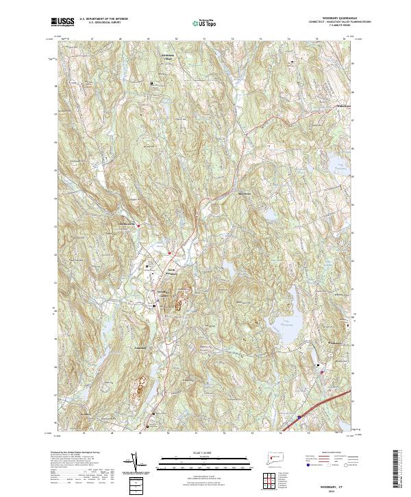
2024 Map of Woodbury
USGS Topo · Published 2024About this map
Bethlehem Village and the historic heart of Woodbury Center define this modern landscape of the Litchfield area. The terrain is characterized by a series of prominent hills, including Carmel Hill and Orenaug Hills, which dictate the winding paths of the Weekeepeemee River and the Nonnewaug River. Cultural landmarks such as the Benedictine Abbey of Regina and various family-named sites like the White Oak Cem offer clear points of interest for genealogists and local historians. The eastern portion of the map is dominated by significant water bodies, notably Lake Quassapaug and Lake Winnemaug, illustrating the transition from the river valleys to the upland lakes. This detailed layout shows the persistent settlement patterns of North Woodbury and Minortown alongside modern developments like the Irish Hills Farms Airport.
Find a feature on this map
225 named features on this map. Tap any name to fly to it.
Don’t see what you’re looking for? This feature index may not catch every label — zoom into the map to look around manually.
Map Details
Editions of this 2024 Woodbury Map
This is the sole edition of this map. No revisions or reprints were ever made.
Other maps of this area

1889 · Derby
USGS Topo · 1:62,500

1891 · Derby
USGS Topo · 1:62,500

1892 · Danbury
USGS Topo · 1:62,500

1892 · New Milford
USGS Topo · 1:62,500

1893 · Waterbury
USGS Topo · 1:62,500

1893 · New Milford
USGS Topo · 1:62,500

1893 · Derby
USGS Topo · 1:62,500

1904 · New Milford
USGS Topo · 1:62,500

1904 · Waterbury
USGS Topo · 1:62,500

1904 · Litchfield
USGS Topo · 1:125,000