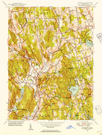
1948 Map of Woodbury
USGS Topo · Published 1953About this map
Regina Laudis Priory sits near the northern boundary of Bethlehem, anchoring a landscape defined by the winding paths of the Weekeepeemee River and Nonewaug River. In the late 1940s, the area shows a distinct cluster of settlements including Hotchkissville, North Woodbury, and the main village of Woodbury, all situated along the primary valley floor. To the east, Lake Quassapaug and Lake Winnemaug dominate the upland terrain, surrounded by numerous smaller water bodies like Cat Swamp Pond and Kelley Pond. The map captures the prominence of local landmarks such as the Taft Sch in Watertown and the Orenaug Hills, which rise sharply above the village center. This survey provides a clear view of the mid-century transition between agricultural land and growing suburban clusters, noted by the presence of several established cemeteries like North Cem and South Cem.
Find a feature on this map
76 named features on this map. Tap any name to fly to it.
Don’t see what you’re looking for? This feature index may not catch every label — zoom into the map to look around manually.
Map Details
Editions of this 1948 Woodbury Map
This is the sole edition of this map. No revisions or reprints were ever made.
Other maps of this area

1889 · Derby
USGS Topo · 1:62,500

1891 · Derby
USGS Topo · 1:62,500

1892 · Danbury
USGS Topo · 1:62,500

1892 · New Milford
USGS Topo · 1:62,500

1893 · Waterbury
USGS Topo · 1:62,500

1893 · New Milford
USGS Topo · 1:62,500

1893 · Derby
USGS Topo · 1:62,500

1904 · New Milford
USGS Topo · 1:62,500

1904 · Waterbury
USGS Topo · 1:62,500

1904 · Litchfield
USGS Topo · 1:125,000