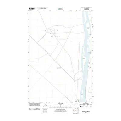
2011 Map of Wooded Island
USGS Topo · Published 2011About this map
The Columbia River flows through this 2011 survey, defining a landscape marked by significant industrial and environmental management. To the west of the river, specialized infrastructure is evident in the presence of the Wye Radioactive Waste Dump and the Three Hundred North Radioactive Waste Dump, connected by the U S Department of Energy Res Rd. These facilities reflect the region's mid-century nuclear heritage and ongoing land use managed by the federal government. Along the river’s course, several landforms rise above the water, including Wooded Island, Homestead Island, and Johnson Island. Near the southern edge of the quadrangle, the small settlement of Ruby sits near the riverbanks, while the interior is dominated by junctions like Geneva Junction and the intersecting paths of Glade North Rd and Wisconsin St. To the east, the terrain is shaped by several drainages, most notably Parsons Canyon, Baxter Canyon, and Rankin Canyon.
Find a feature on this map
19 named features on this map. Tap any name to fly to it.
Don’t see what you’re looking for? This feature index may not catch every label — zoom into the map to look around manually.
Map Details
Editions of this 2011 Wooded Island Map
This is the sole edition of this map. No revisions or reprints were ever made.
Other maps of this area

1917 · Pasco
USGS Topo · 1:125,000

1924 · Hanford
USGS Topo · 1:62,500

1925 · Scooteney Lake
USGS Topo · 1:62,500

1951 · Scooteney Lake
USGS Topo · 1:62,500

1951 · Richland
USGS Topo · 1:62,500

1951 · Hanford
USGS Topo · 1:62,500

1953 · Walla Walla
USGS Topo · 1:250,000

1958 · Walla Walla
USGS Topo · 1:250,000

1965 · Mesa
USGS Topo · 1:62,500

1965 · Eltopia
USGS Topo · 1:62,500