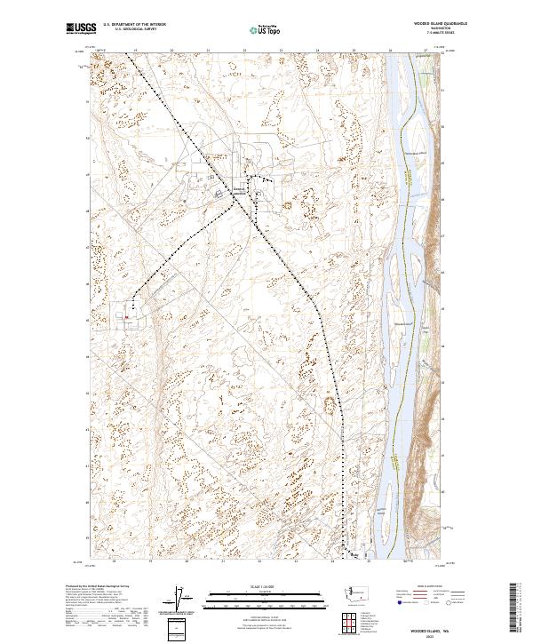
2023 Map of Wooded Island
USGS Topo · Published 2023About this map
Columbia River frontage and federal conservation lands define this portion of the mid-Columbia basin along the border of Benton and Franklin Counties. The landscape is dominated by the Hanford Reach National Monument and the McNary National Wildlife Refuge, which protect the riparian environment and the braided channels surrounding Johnson Island. Inland, the terrain rises toward Ringold Flat, where the high desert is cut by dramatic geographic features like Baxter Canyon and Rankin Canyon. Transportation infrastructure is sparse, restricted largely to service corridors such as the US Department of Energy Res Rd, reflecting the area's specialized role in regional energy and environmental management. A small cluster at Geneva Junction provides a rare point of intersection in this largely uninhabited, protected riverside corridor.
Find a feature on this map
22 named features on this map. Tap any name to fly to it.
Don’t see what you’re looking for? This feature index may not catch every label — zoom into the map to look around manually.
Map Details
Editions of this 2023 Wooded Island Map
This is the sole edition of this map. No revisions or reprints were ever made.
Other maps of this area

1917 · Pasco
USGS Topo · 1:125,000

1924 · Hanford
USGS Topo · 1:62,500

1925 · Scooteney Lake
USGS Topo · 1:62,500

1951 · Scooteney Lake
USGS Topo · 1:62,500

1951 · Richland
USGS Topo · 1:62,500

1951 · Hanford
USGS Topo · 1:62,500

1953 · Walla Walla
USGS Topo · 1:250,000

1958 · Walla Walla
USGS Topo · 1:250,000

1965 · Mesa
USGS Topo · 1:62,500

1965 · Eltopia
USGS Topo · 1:62,500