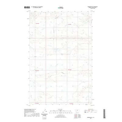
2020 Map of Woodhawk Hill
USGS Topo · Published 2020About this map
Woodhawk Cr and its tributaries define the drainage patterns of this Fergus County landscape, where the Missouri River breaks meet the high plains. The terrain is deeply incised by seasonal waterways including Two Calf Cr and the multiple branches of Taffy Cr, such as the N Fork Taffy Cr. These drainages historically provided vital water sources for livestock in an otherwise arid region. The presence of Hart Spring in the northeast corner further emphasizes the importance of reliable water points for local ranching operations.
Find a feature on this map
17 named features on this map. Tap any name to fly to it.
Don’t see what you’re looking for? This feature index may not catch every label — zoom into the map to look around manually.
Map Details
Editions of this 2020 Woodhawk Hill Map
This is the sole edition of this map. No revisions or reprints were ever made.
Other maps of this area

1954 · Taffy Ridge
USGS Topo · 1:24,000

1954 · Bird Rapids
USGS Topo · 1:24,000

1954 · Leroy
USGS Topo · 1:24,000

1954 · Sturgeon Island
USGS Topo · 1:24,000

1954 · Lewistown
USGS Topo · 1:250,000

1959 · Lewistown
USGS Topo · 1:250,000

1985 · Woodhawk Hill
USGS Topo · 1:24,000
1985 · Gerhard Corner
USGS Topo · 1:24,000
1985 · Winifred East
USGS Topo · 1:24,000
1985 · Reppe Butte
USGS Topo · 1:24,000