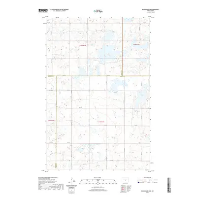
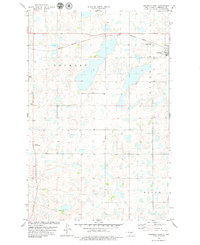
2020 Map of Woodhouse Lake
USGS Topo · Published 2020About this map
Woodhouse Lake serves as the central focal point of this glaciated prairie landscape, where the borders of four North Dakota counties converge. The map documents the intricate legal and agricultural geography of the region, specifically where Sheridan Co, Wells Co, Burleigh Co, and Kidder Co meet. This survey provides a precise view of the section line road grid that structures the rural interior, including routes such as 461st Ave NE and 20th Ave SE. The terrain is characterized by numerous prairie potholes and wetlands typical of the Missouri Coteau, creating a complex hydrologic pattern across the townships of t145n r74w and t144n r74w. This record is particularly valuable for land ownership research and understanding the jurisdictional boundaries in a sparsely populated section of the state.
Find a feature on this map
27 named features on this map. Tap any name to fly to it.
Don’t see what you’re looking for? This feature index may not catch every label — zoom into the map to look around manually.
Map Details
Editions of this 2020 Woodhouse Lake Map
This is the sole edition of this map. No revisions or reprints were ever made.
Other maps of this area

1952 · New Rockford
USGS Topo · 1:250,000

1954 · McClusky
USGS Topo · 1:250,000

1956 · New Rockford
USGS Topo · 1:250,000

1958 · McClusky
USGS Topo · 1:250,000

1971 · New Rockford
USGS Topo · 1:250,000

1972 · Tuttle
USGS Topo · 1:24,000
1978 · Goodrich SW
USGS Topo · 1:24,000
1978 · Goodrich East
USGS Topo · 1:24,000
1978 · Senior Lake
USGS Topo · 1:24,000
1978 · Goodrich West
USGS Topo · 1:24,000