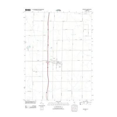
2012 Map of Woodhull
USGS Topo · Published 2012About this map
Woodhull serves as the central hub of this northern Illinois landscape, situated at the intersection of a grid-like network of rural roads and modern thoroughfares. The town's organization is defined by streets like E 4th Ave and W 4th Ave, with a local Po located near the heart of the settlement. The surrounding territory is carved by numerous waterways, most notably Mud Cr, Dugout Cr, and Pope Cr, which dictate the gentle topography of the agricultural land.
Find a feature on this map
59 named features on this map. Tap any name to fly to it.
Don’t see what you’re looking for? This feature index may not catch every label — zoom into the map to look around manually.
Map Details
Editions of this 2012 Woodhull Map
This is the sole edition of this map. No revisions or reprints were ever made.
Other maps of this area

1931 · Galva
USGS Topo · 1:48,000

1934 · Geneseo
USGS Topo · 1:62,500

1937 · Orion
USGS Topo · 1:62,500

1940 · Galva
USGS Topo · 1:62,500

1944 · Galva
USGS Topo · 1:62,500

1947 · Woodhull
USGS Topo · 1:62,500

1953 · Nekoma
USGS Topo · 1:24,000

1953 · Woodhull
USGS Topo · 1:24,000
1953 · Andover
USGS Topo · 1:24,000
1953 · New Windsor
USGS Topo · 1:24,000