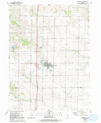
1992 Map of Woodhull
USGS Topo · Published 1992About this map
The village of Woodhull serves as the hub of this prairie landscape at the junction of Henry and Knox Counties during the early 1990s. The town's grid is anchored by civic institutions like the City Hall, Post Office, and Fire Station, while the Alwood High School serves the surrounding farming townships. The transition from rail to highway dominance is visible in the prominent Old Railroad Grade that cuts across Clover and Oxford townships, running parallel to modern transit corridors.
Find a feature on this map
27 named features on this map. Tap any name to fly to it.
Don’t see what you’re looking for? This feature index may not catch every label — zoom into the map to look around manually.
Map Details
Editions of this 1992 Woodhull Map
This is the sole edition of this map. No revisions or reprints were ever made.
Other maps of this area

1931 · Galva
USGS Topo · 1:48,000

1934 · Geneseo
USGS Topo · 1:62,500

1937 · Orion
USGS Topo · 1:62,500

1940 · Galva
USGS Topo · 1:62,500

1944 · Galva
USGS Topo · 1:62,500

1947 · Woodhull
USGS Topo · 1:62,500

1953 · Nekoma
USGS Topo · 1:24,000

1953 · Woodhull
USGS Topo · 1:24,000
1953 · Andover
USGS Topo · 1:24,000
1953 · New Windsor
USGS Topo · 1:24,000