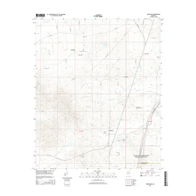
2015 Map of Woodland
USGS Topo · Published 2015About this map
Woodland serves as the primary hub in this portion of Chickasaw County, where Main ST and Grady ST anchor the local road network. The landscape is defined by the headwaters and tributaries of the Yalobusha River and Prairie Cr, creating a complex topography of ridges and creek bottoms. This era of the mid-2010s shows a well-established rural infrastructure, including the Shenandoah Valley Farms Airport and the prominent diagonal corridor of the Natchez Trace Pkwy.
Find a feature on this map
58 named features on this map. Tap any name to fly to it.
Don’t see what you’re looking for? This feature index may not catch every label — zoom into the map to look around manually.
Map Details
Editions of this 2015 Woodland Map
This is the sole edition of this map. No revisions or reprints were ever made.
Other maps of this area

1953 · West Point
USGS Topo · 1:250,000

1958 · West Point
USGS Topo · 1:250,000

1959 · Van Vleet
USGS Topo · 1:62,500

1959 · Pheba
USGS Topo · 1:62,500

1963 · West Point
USGS Topo · 1:250,000

1972 · Atlanta
USGS Topo · 1:24,000

1972 · Vardaman
USGS Topo · 1:24,000

1972 · Hohenlinden
USGS Topo · 1:24,000
1972 · Houston West
USGS Topo · 1:24,000

1972 · Mantee
USGS Topo · 1:24,000