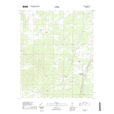
2020 Map of Woodland
USGS Topo · Published 2020About this map
Woodland anchors this section of northeast Mississippi, serving as a central hub for the surrounding rural communities of Tabbville and Anchor. The landscape is defined by the winding paths of Chewawah Cr, Cane Cr, and Sewaqiah Cr, which drain the low-lying agricultural terrain. Along the eastern edge, the Natchez Trace Parkway cuts a modern path through the countryside, roughly paralleling the Chickasaw and Clay County line.
Find a feature on this map
62 named features on this map. Tap any name to fly to it.
Don’t see what you’re looking for? This feature index may not catch every label — zoom into the map to look around manually.
Map Details
Editions of this 2020 Woodland Map
This is the sole edition of this map. No revisions or reprints were ever made.
Other maps of this area

1953 · West Point
USGS Topo · 1:250,000

1958 · West Point
USGS Topo · 1:250,000

1959 · Van Vleet
USGS Topo · 1:62,500

1959 · Pheba
USGS Topo · 1:62,500

1963 · West Point
USGS Topo · 1:250,000

1972 · Atlanta
USGS Topo · 1:24,000

1972 · Vardaman
USGS Topo · 1:24,000

1972 · Hohenlinden
USGS Topo · 1:24,000
1972 · Houston West
USGS Topo · 1:24,000

1972 · Mantee
USGS Topo · 1:24,000