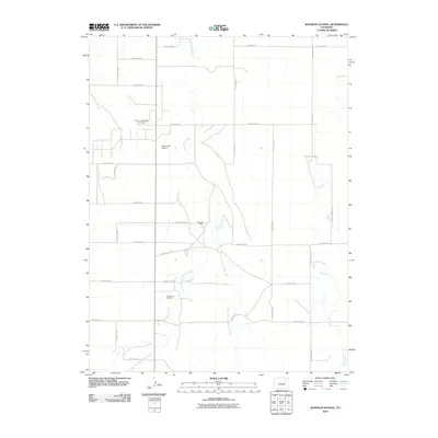
2010 Map of Woodlin School
USGS Topo · Published 2010About this map
Plumb Bush Creek Oil Field and the surrounding energy landscape of eastern Colorado define this 2010 topographic study. The map illustrates a high plains environment dominated by a rigorous grid of section roads, including County RD-19 and County Road J, which facilitate access to remote energy infrastructure. This industrial presence is concentrated at sites like Ramp Oil Field and West Fork Oil Field. In addition to the oil industry, the geography is marked by the private Chenoweth Airport, serving the region's aviation needs.
Find a feature on this map
25 named features on this map. Tap any name to fly to it.
Don’t see what you’re looking for? This feature index may not catch every label — zoom into the map to look around manually.
Map Details
Editions of this 2010 Woodlin School Map
This is the sole edition of this map. No revisions or reprints were ever made.
Other maps of this area

1954 · Limon
USGS Topo · 1:250,000

1957 · Limon
USGS Topo · 1:250,000

1958 · Limon
USGS Topo · 1:250,000

1973 · Woodrow
USGS Topo · 1:24,000

1973 · Antelope Creek West
USGS Topo · 1:24,000

1973 · Dry Gulch
USGS Topo · 1:24,000

1973 · Last Chance NW
USGS Topo · 1:24,000
1973 · Woodrow NW
USGS Topo · 1:24,000

1973 · Lindon
USGS Topo · 1:24,000

1973 · Last Chance
USGS Topo · 1:24,000