
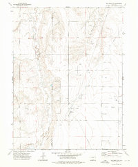
1973 Map of Woodrow
USGS Topo · Published 1975About this map
The community of Woodrow serves as the primary focal point in this 1970s survey of the High Plains on the boundary of Washington County. This era reflects a landscape defined by natural drainage and mineral extraction, with the extensive Kejr Oil Field occupying the southwest portion of the quadrangle. A network of numerous Oil Wells is scattered across the terrain, indicating the intensity of energy development during this period. The hydrology of the region is dominated by the meandering paths of Beaver Creek, Sand Creek, and Plum Bush Creek, which cut through the open country. Human infrastructure is sparsely represented, characterized by a Substa and a grid of rural roads and fence lines that segment the land for agricultural and industrial use.
Find a feature on this map
9 named features on this map. Tap any name to fly to it.
Don’t see what you’re looking for? This feature index may not catch every label — zoom into the map to look around manually.
Map Details
Editions of this 1973 Woodrow Map
This is the sole edition of this map. No revisions or reprints were ever made.
Other maps of this area

1954 · Limon
USGS Topo · 1:250,000

1954 · Sterling
USGS Topo · 1:250,000

1957 · Limon
USGS Topo · 1:250,000

1958 · Limon
USGS Topo · 1:250,000

1958 · Sterling
USGS Topo · 1:250,000

1965 · Gary
USGS Topo · 1:24,000

1965 · Huey Ranch
USGS Topo · 1:24,000

1973 · Antelope Creek West
USGS Topo · 1:24,000

1973 · Dry Gulch
USGS Topo · 1:24,000
1973 · Woodrow NW
USGS Topo · 1:24,000