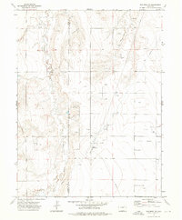
1973 Map of Woodrow NW
USGS Topo · Published 1976About this map
The industrial development of the high plains in eastern Colorado is the focal point of this 1970s topographical record. Centered on the boundary of Adams Co Washington Co, the landscape is defined by the extensive Oil Field infrastructure that marks the undulating terrain. Energy extraction dominates the local economy here, evidenced by numerous Oil Wells, scattered Drill Hole sites, and the specialized Arapahoe Pumping Sta. This network is supported by an intricate system of linear utilities, including a major north-south Pipeline and an Aqueduct that crosses the southern portion of the sheet.
Find a feature on this map
11 named features on this map. Tap any name to fly to it.
Don’t see what you’re looking for? This feature index may not catch every label — zoom into the map to look around manually.
Map Details
Editions of this 1973 Woodrow NW Map
This is the sole edition of this map. No revisions or reprints were ever made.
Other maps of this area

1954 · Limon
USGS Topo · 1:250,000

1954 · Sterling
USGS Topo · 1:250,000

1957 · Limon
USGS Topo · 1:250,000

1958 · Limon
USGS Topo · 1:250,000

1958 · Sterling
USGS Topo · 1:250,000

1965 · Gary
USGS Topo · 1:24,000

1965 · Vallery SE
USGS Topo · 1:24,000

1965 · Huey Ranch
USGS Topo · 1:24,000

1973 · Woodrow
USGS Topo · 1:24,000

1973 · Shamrock
USGS Topo · 1:24,000