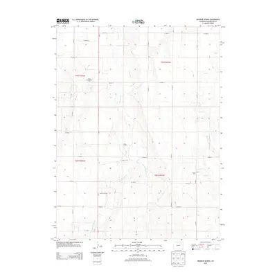
2013 Map of Woodlin School
USGS Topo · Published 2013About this map
Woodlin School stands as a central landmark in this portion of Washington County, anchoring a landscape defined by an extensive grid of county roads and the natural drainage patterns of the high plains. The geography is shaped by the subtle valleys of Plum Bush Cr and its tributaries, including E Fork Plum Bush Cr and W Fork Plum Bush Cr, which cut through the open terrain.
Find a feature on this map
24 named features on this map. Tap any name to fly to it.
Don’t see what you’re looking for? This feature index may not catch every label — zoom into the map to look around manually.
Map Details
Editions of this 2013 Woodlin School Map
This is the sole edition of this map. No revisions or reprints were ever made.
Other maps of this area

1954 · Limon
USGS Topo · 1:250,000

1957 · Limon
USGS Topo · 1:250,000

1958 · Limon
USGS Topo · 1:250,000

1973 · Woodrow
USGS Topo · 1:24,000

1973 · Antelope Creek West
USGS Topo · 1:24,000

1973 · Dry Gulch
USGS Topo · 1:24,000

1973 · Last Chance NW
USGS Topo · 1:24,000
1973 · Woodrow NW
USGS Topo · 1:24,000

1973 · Lindon
USGS Topo · 1:24,000

1973 · Last Chance
USGS Topo · 1:24,000