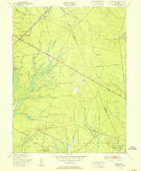
1951 Map of Woodmansie
USGS Topo · Published 1951About this map
Lebanon State Forest and Penn State Forest dominate this section of the New Jersey Pine Barrens, where the landscape is defined by the intricate hydrology of cedar swamps and sandy plains. At the northern edge of the map, the settlement of Woodmansie sits along the Central Railroad of New Jersey, a vital corridor for the local cranberry industry. The prevalence of Cranberry Bogs, including the Goodwater Cranberry Bog, reflects the specialized agriculture that has long shaped the regional economy.
Find a feature on this map
42 named features on this map. Tap any name to fly to it.
Don’t see what you’re looking for? This feature index may not catch every label — zoom into the map to look around manually.
Map Details
Editions of this 1951 Woodmansie Map
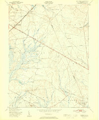
2 editions found
Other maps of this area

1884 · Whitings
USGS Topo · 1:62,500

1888 · Pemberton
USGS Topo · 1:62,500

1888 · Little Egg Harbor
USGS Topo · 1:62,500

1888 · Whitings
USGS Topo · 1:62,500

1890 · Mullica
USGS Topo · 1:62,500

1893 · Little Egg Harbor
USGS Topo · 1:62,500

1894 · Pemberton
USGS Topo · 1:62,500

1894 · Mullica
USGS Topo · 1:62,500

1898 · Pemberton
USGS Topo · 1:62,500

1898 · Mullica
USGS Topo · 1:62,500
Featured Places
- Manchester Township, NJ
- Stafford Township, NJ
- Lacey Township, NJ
- Barnegat Township, NJ
- Little Egg Harbor Township, NJ