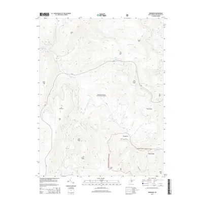
2014 Map of Woodrow
USGS Topo · Published 2014About this map
Woodrow and West Union sit at the center of this high-elevation landscape within the Monongahela National Forest, where the headwaters of the Williams River and numerous mountain runs carve through the Yew Mountains. The map reveals a region defined by its extreme topography, marked by prominent peaks such as Big Spruce Knob and Tea Creek Mtn. The intricate network of forest roads, including fs150, provides the primary access to these remote summits and the Red Lick Overlook Point of Interest. Local history is preserved in the naming of small water sources like Stoney Creek Mountain Spring and Cockrane Spring, and the branching forks of Little Laurel Cr and Right Fork Tea Cr. This survey illustrates the protected status of the land, showing how the national forest boundary encompasses nearly the entire quadrangle, preserving the character of these highlands.
Find a feature on this map
37 named features on this map. Tap any name to fly to it.
Don’t see what you’re looking for? This feature index may not catch every label — zoom into the map to look around manually.
Map Details
Editions of this 2014 Woodrow Map
This is the sole edition of this map. No revisions or reprints were ever made.
Other maps of this area

1891 · Huntersville
USGS Topo · 1:125,000

1894 · Huntersville
USGS Topo · 1:125,000

1915 · Webster Springs
USGS Topo · 1:48,000

1918 · Webster Springs
USGS Topo · 1:62,500

1923 · Lobelia
USGS Topo · 1:48,000

1923 · Marlinton
USGS Topo · 1:48,000

1923 · Mingo
USGS Topo · 1:48,000

1925 · Mingo
USGS Topo · 1:62,500

1925 · Marlinton
USGS Topo · 1:62,500

1925 · Lobelia
USGS Topo · 1:62,500