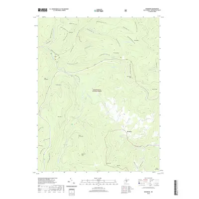
2019 Map of Woodrow
USGS Topo · Published 2019About this map
Monongahela National Forest land dominates this section of Pocahontas County, where a vast network of wilderness trails and high-elevation peaks defines the landscape. The small settlement of Woodrow sits near the headwaters of Stony Creek, surrounded by prominent summits including Red Spruce Knob, Black Mtn, and the Yew Mountains. The Williams River carves a deep valley through the center of the sheet, joined by numerous tributaries such as Big Laurel Creek and Tea Creek. This area is characterized by its high-country water sources and difficult terrain, evidenced by features like Cockrane Spring and Stoney Creek Mountain Spring. An extensive trail system, including the Boundary Trail # 449 and Black Mountain Trail # 412, illustrates the area's transition from early timber and resource access to its modern role as a protected wilderness and recreational forest.
Find a feature on this map
51 named features on this map. Tap any name to fly to it.
Don’t see what you’re looking for? This feature index may not catch every label — zoom into the map to look around manually.
Map Details
Editions of this 2019 Woodrow Map
This is the sole edition of this map. No revisions or reprints were ever made.
Other maps of this area

1891 · Huntersville
USGS Topo · 1:125,000

1894 · Huntersville
USGS Topo · 1:125,000

1915 · Webster Springs
USGS Topo · 1:48,000

1918 · Webster Springs
USGS Topo · 1:62,500

1923 · Lobelia
USGS Topo · 1:48,000

1923 · Marlinton
USGS Topo · 1:48,000

1923 · Mingo
USGS Topo · 1:48,000

1925 · Mingo
USGS Topo · 1:62,500

1925 · Marlinton
USGS Topo · 1:62,500

1925 · Lobelia
USGS Topo · 1:62,500