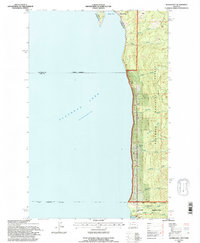
1994 Map of Woods Bay
USGS Topo · Published 1995About this map
Flathead Lake dominates the western half of this landscape, its expansive waters meeting a shoreline defined by the steep eastern front of the Flathead National Forest. This 1994 revision reflects a mixture of public lands and the northern edge of an Indian Reservation. The settlement of Woods Bay sits at the northern end, while the southern shoreline near Yellow Bay reveals specialized landmarks like the U of M Biological Station and the Flathead Community Center. Numerous drainages carve through the timbered slopes, including uniquely named features such as No-see-um Creek, Hunger Creek, and Gunderson Creek. The map provides a look at the intersection of forest management, tribal boundaries, and lakeside development in the mid-1990s.
Find a feature on this map
21 named features on this map. Tap any name to fly to it.
Don’t see what you’re looking for? This feature index may not catch every label — zoom into the map to look around manually.
Map Details
Editions of this 1994 Woods Bay Map
This is the sole edition of this map. No revisions or reprints were ever made.
Other maps of this area

1914 · Nyack
USGS Topo · 1:125,000

1920 · Flathead Lake
USGS Topo · 1:125,000

1943 · Kalispell
USGS Topo · 1:125,000

1955 · Choteau
USGS Topo · 1:250,000

1956 · Wallace
USGS Topo · 1:250,000

1957 · Choteau
USGS Topo · 1:250,000

1957 · Kalispell
USGS Topo · 1:250,000

1958 · Choteau
USGS Topo · 1:250,000

1960 · Kalispell
USGS Topo · 1:250,000

1960 · Wallace
USGS Topo · 1:250,000