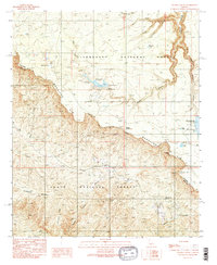
1990 Map of Woods Canyon
USGS Topo · Published 1991About this map
The Mogollon Rim escarpment dominates this landscape, serving as a dramatic natural divide between the high plateau of the Sitgreaves National Forest and the lower elevations of the Tonto National Forest. In this 1990 survey, the area is characterized by developed recreational sites near the Woods Canyon Dam, including the Rocky Point Recreation Site and the Aspen Recreation Site. The presence of numerous named springs, such as Allenbaugh Spring and Colcord Spring, highlights the critical water sources for local wildlife and forest management in this arid environment.
Find a feature on this map
38 named features on this map. Tap any name to fly to it.
Don’t see what you’re looking for? This feature index may not catch every label — zoom into the map to look around manually.
Map Details
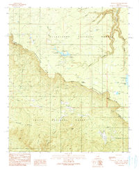
Editions of this 1990 Woods Canyon Map
2 editions found
Other maps of this area

1886 · Holbrook
USGS Topo · 1:250,000

1887 · Verde
USGS Topo · 1:250,000

1892 · Verde
USGS Topo · 1:250,000

1893 · Holbrook
USGS Topo · 1:250,000

1934 · Promontory Butte
USGS Topo · 1:62,500

1937 · Diamond Butte
USGS Topo · 1:48,000

1939 · Promontory Butte
USGS Topo · 1:62,500

1943 · Diamond Butte
USGS Topo · 1:62,500

1952 · Promontory Butte
USGS Topo · 1:62,500

1954 · Holbrook
USGS Topo · 1:250,000
Featured Places
- Colcord Mountain Estates, AZ
- Ponderosa Spring Subdivision, AZ
- Sleepy Hollow, AZ
- Coconino County, AZ
- Gila County, AZ