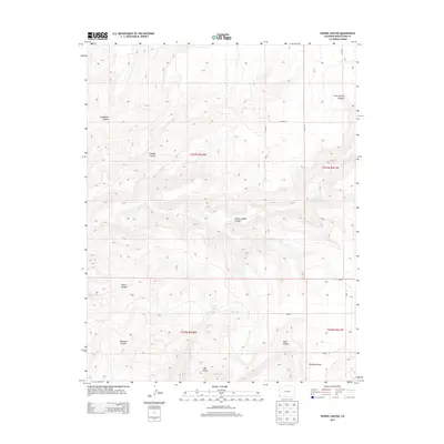
2013 Map of Woods Canyon
USGS Topo · Published 2013About this map
Goodman Point serves as a primary marker in this high-desert landscape of Southwest Colorado, where a complex network of drainage systems defines the terrain. The central geography is dominated by deeply incised features such as Woods Canyon and Yellow Jacket Canyon, which channel seasonal runoff toward the southwest. Water resources are sparse but notable, including the isolated Moqui Lake and the drainage of Rock Cr. The map reveals a transition from the plateau-like summits of Big Point to the intricate, branching systems of Sandstone Canyon and Moccasin Canyon. This 2013 survey provides a clear view of the county road grid, including Co Road U and Road N, which navigate the mesa tops between these significant natural barriers. The drainage pattern, with canyons like Sand Canyon and Cave Spring Canyon, suggests a landscape where movement was historically dictated by the steep topography of the Four Corners region.
Find a feature on this map
22 named features on this map. Tap any name to fly to it.
Don’t see what you’re looking for? This feature index may not catch every label — zoom into the map to look around manually.
Map Details
Editions of this 2013 Woods Canyon Map
This is the sole edition of this map. No revisions or reprints were ever made.
Other maps of this area

1956 · Cortez
USGS Topo · 1:250,000

1957 · Moqui NW
USGS Topo · 1:24,000

1957 · Cedar 3 SW
USGS Topo · 1:24,000

1957 · Moqui SW
USGS Topo · 1:24,000

1957 · Moqui SE
USGS Topo · 1:24,000

1958 · Cortez SW
USGS Topo · 1:24,000

1958 · Cortez
USGS Topo · 1:250,000

1959 · Cortez
USGS Topo · 1:250,000

1962 · Cortez
USGS Topo · 1:250,000

1965 · Woods Canyon
USGS Topo · 1:24,000