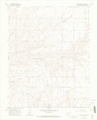
1965 Map of Woods Canyon
USGS Topo · Published 1967This historical map portrays the area of Woods Canyon in 1965, primarily covering Montezuma County. Featuring a scale of 1:24000, this map provides a highly detailed snapshot of the terrain, roads, buildings, counties, and historical landmarks in the Woods Canyon region at the time. Published in 1967, it is one of 4 known editions of this map due to revisions or reprints.
Find a feature on this map
15 named features on this map. Tap any name to fly to it.
Don’t see what you’re looking for? This feature index may not catch every label — zoom into the map to look around manually.
Map Details
Editions of this 1965 Woods Canyon Map
4 editions found
Historical Maps of Montezuma County Through Time
75 maps found

1912 Soda Canyon
Montezuma County, CO

1915 Soda Canyon
Montezuma County, CO

1957 Cedar 3 SW
Montezuma County, CO

1957 Moqui NW
Montezuma County, CO

1957 Moqui SE
Montezuma County, CO

1957 Moqui SW
Montezuma County, CO

1958 Cortez SW
Montezuma County, CO

1958 Sentinel Peak NE
Montezuma County, CO

1958 Sentinel Peak NW
Montezuma County, CO

1963 Orphan Butte
Montezuma County, CO

1963 Rampart Hills
Montezuma County, CO

1963 Stoner
Montezuma County, CO

1963 Wallace Ranch
Montezuma County, CO

1965 Arriola
Montezuma County, CO

1965 Boggy Draw
Montezuma County, CO

1965 Dolores East
Montezuma County, CO

1965 Dolores West
Montezuma County, CO

1965 Millwood
Montezuma County, CO

1965 Pleasant View
Montezuma County, CO

1965 Point Lookout
Montezuma County, CO

1965 Trimble Point
Montezuma County, CO

1965 Woods Canyon
Montezuma County, CO

1965 Yellow Jacket
Montezuma County, CO

1966 Greasewood Canyon
Montezuma County, CO

1966 Moqui Canyon
Montezuma County, CO

1966 Sentinel Peak SE
Montezuma County, CO

1966 Sentinel Peak SW
Montezuma County, CO

1966 Tanner Mesa
Montezuma County, CO

1966 Trail Canyon
Montezuma County, CO

1966 Wetherill Mesa
Montezuma County, CO

1967 Moccasin Mesa
Montezuma County, CO

1972 Cortez SW
Montezuma County, CO

1979 Battle Rock
Montezuma County, CO

1979 Bowdish Canyon
Montezuma County, CO

1979 Mariano Wash East
Montezuma County, CO

1979 Mariano Wash West
Montezuma County, CO

1979 Mud Creek
Montezuma County, CO

1979 Negro Canyon
Montezuma County, CO

1979 Ruin Canyon
Montezuma County, CO

1993 Boggy Draw
Montezuma County, CO

1993 Trimble Point
Montezuma County, CO

1994 Arriola
Montezuma County, CO

1994 Negro Canyon
Montezuma County, CO

1994 Pleasant View
Montezuma County, CO

1994 Ruin Canyon
Montezuma County, CO

1994 Woods Canyon
Montezuma County, CO

2022 Arriola
Montezuma County, CO

2022 Battle Rock
Montezuma County, CO

2022 Boggy Draw
Montezuma County, CO

2022 Bowdish Canyon
Montezuma County, CO

2022 Dolores East
Montezuma County, CO

2022 Dolores West
Montezuma County, CO

2022 Greasewood Canyon
Montezuma County, CO

2022 Mariano Wash East
Montezuma County, CO

2022 Mariano Wash West
Montezuma County, CO

2022 Millwood
Montezuma County, CO

2022 Moccasin Mesa
Montezuma County, CO

2022 Moqui Canyon
Montezuma County, CO

2022 Mud Creek
Montezuma County, CO

2022 Negro Canyon
Montezuma County, CO

2022 Orphan Butte
Montezuma County, CO

2022 Pleasant View
Montezuma County, CO

2022 Point Lookout
Montezuma County, CO

2022 Rampart Hills
Montezuma County, CO

2022 Sentinel Peak SE
Montezuma County, CO

2022 Sentinel Peak SW
Montezuma County, CO

2022 Stoner
Montezuma County, CO

2022 Tanner Mesa
Montezuma County, CO

2022 Trail Canyon
Montezuma County, CO

2022 Trimble Point
Montezuma County, CO

2022 Wallace Ranch
Montezuma County, CO

2022 Wetherill Mesa
Montezuma County, CO

2022 Woods Canyon
Montezuma County, CO

2022 Yellow Jacket
Montezuma County, CO

2023 Ruin Canyon
Montezuma County, CO