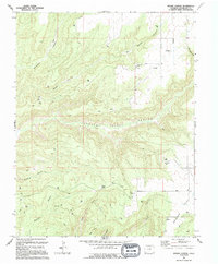
1994 Map of Woods Canyon
USGS Topo · Published 1994About this map
Yellow Jacket Canyon and Woods Canyon dominate this landscape in Montezuma County, where deep drainages carve through high mesas. The terrain is marked by the presence of Moqui Lake and the winding course of Rock Creek, which flows past high elevations like Goodman Point and Big Point. This mid-1990s record captures a region defined by its resource extraction and infrastructure, showing numerous scattered Gas Wells and Drill Holes alongside modern utility markers such as a Substa and multiple Radio Towers.
Find a feature on this map
28 named features on this map. Tap any name to fly to it.
Don’t see what you’re looking for? This feature index may not catch every label — zoom into the map to look around manually.
Map Details
Editions of this 1994 Woods Canyon Map
This is the sole edition of this map. No revisions or reprints were ever made.
Other maps of this area

1956 · Cortez
USGS Topo · 1:250,000

1957 · Moqui NW
USGS Topo · 1:24,000

1957 · Cedar 3 SW
USGS Topo · 1:24,000

1957 · Moqui SW
USGS Topo · 1:24,000

1957 · Moqui SE
USGS Topo · 1:24,000

1958 · Cortez SW
USGS Topo · 1:24,000

1958 · Cortez
USGS Topo · 1:250,000

1959 · Cortez
USGS Topo · 1:250,000

1962 · Cortez
USGS Topo · 1:250,000

1965 · Woods Canyon
USGS Topo · 1:24,000