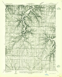
1934 Map of Woods Chapel
USGS Topo · Published 1955About this map
The Little Blue River carves a winding path through the heart of Jackson County in this mid-1930s survey, showing the terrain as it transitioned from rural school districts to established townships. Small rural education centers like Colborn Sch, Tennyson Sch, and Center Point Sch appear as vital community hubs before the mid-century trend of district consolidation. Near the northeastern edge, the development around Lake Lotawana is clearly visible, marking the area’s growth as a residential and recreational destination.
Find a feature on this map
14 named features on this map. Tap any name to fly to it.
Don’t see what you’re looking for? This feature index may not catch every label — zoom into the map to look around manually.
Map Details
Editions of this 1934 Woods Chapel Map
2 editions found
Other maps of this area

1887 · Harrisonville
USGS Topo · 1:125,000

1892 · Harrisonville
USGS Topo · 1:125,000

1894 · Harrisonville
USGS Topo · 1:125,000

1894 · Independence
USGS Topo · 1:125,000

1933 · Blue Springs
USGS Topo · 1:24,000

1934 · Oak Grove
USGS Topo · 1:24,000

1934 · Independence
USGS Topo · 1:24,000

1934 · Lees Summit
USGS Topo · 1:24,000

1934 · Woods Chapel
USGS Topo · 1:24,000

1935 · Tarsney
USGS Topo · 1:24,000