1974 Map of Woods SW
USGS Topo · Published 1976About this map
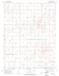
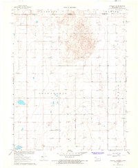
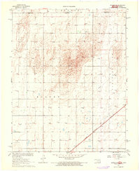
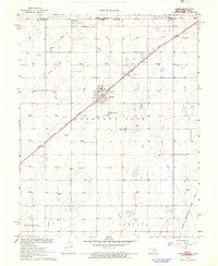
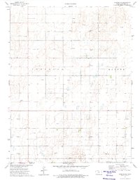
The high plains of Stevens County and the northern border of the Oklahoma Panhandle are defined here by a systematic grid of energy extraction and agricultural boundaries. Mapping the township of Banner in the mid-1970s, this survey reveals a landscape transformed by the petrochemical industry, with numerous Gas Wells and Oil Wells peppered across the section lines. Despite the industrial footprint, the community's spiritual center remains visible at Bethel Ch in the northwestern quadrant. The map provides a distinct look at the intersection of state lines, where Kansas and Oklahoma meet, capturing the specific field and fence lines that partitioned this portion of the Great Plains during the era of intensified natural gas production.
Find a feature on this map
6 named features on this map. Tap any name to fly to it.
Don’t see what you’re looking for? This feature index may not catch every label — zoom into the map to look around manually.
Map Details
Editions of this 1974 Woods SW Map
This is the sole edition of this map. No revisions or reprints were ever made.
Other maps of this area

1954 · Perryton
USGS Topo · 1:250,000

1955 · Dodge City
USGS Topo · 1:250,000

1958 · Perryton
USGS Topo · 1:250,000

1958 · Dodge City
USGS Topo · 1:250,000

1959 · Dodge City
USGS Topo · 1:250,000
1967 · Straight NE
USGS Topo · 1:24,000
1967 · Hooker NW
USGS Topo · 1:24,000
1967 · Tyrone
USGS Topo · 1:24,000
1974 · Hugoton SE
USGS Topo · 1:24,000
1974 · Hugoton
USGS Topo · 1:24,000