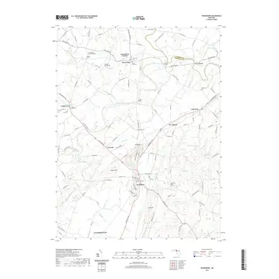
2019 Map of Woodsboro
USGS Topo · Published 2019About this map
Woodsboro and Rocky Ridge anchor this Frederick County landscape, where the Monocacy River and Double Pipe Creek define the agricultural and transport corridors of north-central Maryland. The map reveals a dense network of early crossings and community centers, including the landmark Loys Station Covered Bridge near Loys and the Le Gore Bridge further south. These structural markers, alongside numerous family-named landmarks like Millers Bridge and Old Mill Road Bridge, reflect a history tied closely to the region's waterways and milling heritage. Local genealogy is well-represented through scattered burial grounds such as Saint Peters Rocky Hill Cem, Mount Tabor Cem, and Haughs Cem. From the southern reach of Walkersville to the rural hamlets of Ladiesburg and New Midway, the survey details the persistent rural character and the enduring road network, from the Woodsboro Pike to the winding tracks of Old Frederick Rd.
Find a feature on this map
122 named features on this map. Tap any name to fly to it.
Don’t see what you’re looking for? This feature index may not catch every label — zoom into the map to look around manually.
Map Details
Editions of this 2019 Woodsboro Map
This is the sole edition of this map. No revisions or reprints were ever made.
Other maps of this area

1893 · Frederick
USGS Topo · 1:125,000

1894 · Frederick
USGS Topo · 1:125,000

1908 · Ijamsville
USGS Topo · 1:62,500

1909 · Mount Airy
USGS Topo · 1:62,500

1909 · Ijamsville
USGS Topo · 1:62,500

1911 · Taneytown
USGS Topo · 1:62,500

1911 · Emmitsburg
USGS Topo · 1:62,500

1942 · Frederick
USGS Topo · 1:62,500

1942 · Gettysburg
USGS Topo · 1:125,000

1943 · Emmitsburg
USGS Topo · 1:62,500