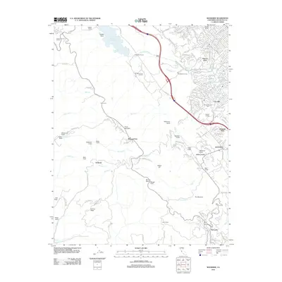
2012 Map of Woodside
USGS Topo · Published 2012About this map
Filoli Mansion and Gardens and the Pulgas Water Temple anchor the northern landscape of this 2012 survey, marking a region defined by extensive water infrastructure and preserved estates. The Hetch Hetchy Aqueduct and Pulgas Tunnel move water toward the Upper Crystal Springs Reservoir, highlighting the area's critical role in the regional supply system. To the east, residential enclaves like Palomar Park and Farm Hills border the academic grounds of Canada College.
Find a feature on this map
168 named features on this map. Tap any name to fly to it.
Don’t see what you’re looking for? This feature index may not catch every label — zoom into the map to look around manually.
Map Details
Editions of this 2012 Woodside Map
This is the sole edition of this map. No revisions or reprints were ever made.
Other maps of this area

1892 · San Mateo
USGS Topo · 1:62,500

1896 · San Mateo
USGS Topo · 1:62,500

1897 · Palo Alto
USGS Topo · 1:62,500

1899 · Palo Alto
USGS Topo · 1:62,500

1899 · Haywards
USGS Topo · 1:62,500

1899 · San Mateo
USGS Topo · 1:62,500

1902 · Santa Cruz
USGS Topo · 1:125,000

1915 · San Mateo
USGS Topo · 1:62,500

1915 · Haywards
USGS Topo · 1:62,500

1939 · San Mateo
USGS Topo · 1:62,500