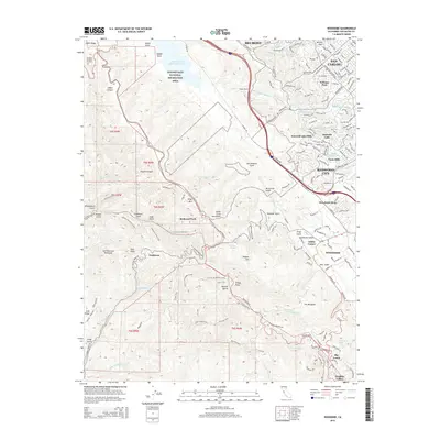
2015 Map of Woodside
USGS Topo · Published 2015About this map
The San Andreas Fault cuts a distinct northwest-southeast path through the Santa Cruz Mountains, defining the geography of this mid-peninsula region. On the eastern slopes, the residential growth of Redwood City, San Carlos, and Woodside meets the edges of the Golden Gate National Recreation Area. The infrastructure of the San Francisco Peninsula is clearly visible through the Hetch Hetchy Aqueduct and the Pulgas Tunnel, which facilitate water transport across the heights. Higher elevations are marked by a dense network of trails such as the Sierra Morena Trail and Tafoni Trail, alongside significant peaks like Teague Hill and Bald Knob. The presence of Grabtown and Sky Londa reflects the more isolated mountain communities that stand in contrast to the developed corridors of the lower valleys.
Find a feature on this map
83 named features on this map. Tap any name to fly to it.
Don’t see what you’re looking for? This feature index may not catch every label — zoom into the map to look around manually.
Map Details
Editions of this 2015 Woodside Map
This is the sole edition of this map. No revisions or reprints were ever made.
Other maps of this area

1892 · San Mateo
USGS Topo · 1:62,500

1896 · San Mateo
USGS Topo · 1:62,500

1897 · Palo Alto
USGS Topo · 1:62,500

1899 · Palo Alto
USGS Topo · 1:62,500

1899 · Haywards
USGS Topo · 1:62,500

1899 · San Mateo
USGS Topo · 1:62,500

1902 · Santa Cruz
USGS Topo · 1:125,000

1915 · San Mateo
USGS Topo · 1:62,500

1915 · Haywards
USGS Topo · 1:62,500

1939 · San Mateo
USGS Topo · 1:62,500