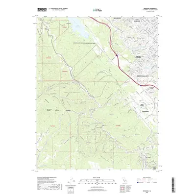
2018 Map of Woodside
USGS Topo · Published 2018About this map
Golden Gate National Recreation Area dominates this section of the Santa Cruz Mountains, where the modern infrastructure of the San Francisco Peninsula meets densely wooded canyons and ridges. The map reveals the intricate water system of the region, featuring the Upper Crystal Springs Reservoir and the subterranean path of the Hetch Hetchy Aqueduct, which surfaces briefly at the Pulgas Tunnel. Residential growth is concentrated along the eastern foothills in communities like Emerald Lake Hills and Woodside Glens, while the western slopes remain defined by rugged gulches and ridges.
Find a feature on this map
215 named features on this map. Tap any name to fly to it.
Don’t see what you’re looking for? This feature index may not catch every label — zoom into the map to look around manually.
Map Details
Editions of this 2018 Woodside Map
This is the sole edition of this map. No revisions or reprints were ever made.
Other maps of this area

1892 · San Mateo
USGS Topo · 1:62,500

1896 · San Mateo
USGS Topo · 1:62,500

1897 · Palo Alto
USGS Topo · 1:62,500

1899 · Palo Alto
USGS Topo · 1:62,500

1899 · Haywards
USGS Topo · 1:62,500

1899 · San Mateo
USGS Topo · 1:62,500

1902 · Santa Cruz
USGS Topo · 1:125,000

1915 · San Mateo
USGS Topo · 1:62,500

1915 · Haywards
USGS Topo · 1:62,500

1939 · San Mateo
USGS Topo · 1:62,500